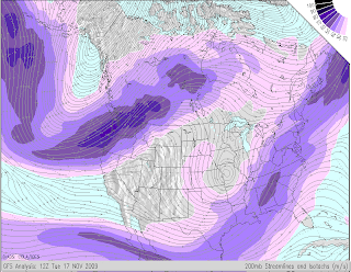
 Isotachs are contour lines on a given surface connecting points with equal wind speed. This map shows 200 mb isotachs and streamlines.
- Purple shading indicates the speed of the winds at the 200 millibar level, in meters per second.
- The streamlines indicate the direction of flow of the wind, which is generally from west to east throughout most of the subtropics, mid- and high-latitudes.
- The color of the streamlines indicates a relative measure of divergence of the flow in the upper troposphere. Orange and red indicates strong divergence at upper levels, usually associated with strong vertical velocities in the middle troposphere, and severe weather/heavy rainfall.
http://wxmaps.org/pix/avnmr5.00hr.png

No comments:
Post a Comment