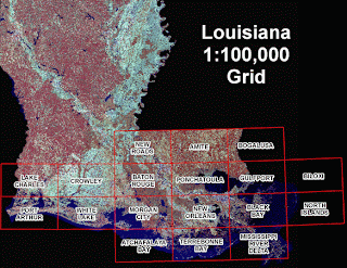
DOQQs (Digital Orthographic Quarter-Quads) combine the image characteristics of an aerial photograph with the geometric qualities of a map. DOQQs are orthorectified, which removes distortion out of aerial photos so that they can be used as flat maps, this allows for more accurate measurement of distance, areas, angles, and positions.
This is an image taken in 2005 of Louisiana after Hurricane Katrina and Rita hit. This photography extends from Gulfport, MS to Sabine Lake, LA and includes areas impacted by Hurricanes Katrina and Rita. Funding for the photography was provided by the Coastal Wetlands Planning, Protection and Restoration Act, Coastwide Reference Monitoring Program (CWPPRA - CRMS), with additional funding provided by the Louisiana Department of Environmental Quality and the U.S. Geological Survey to expand coverage to assist in hurricane recovery.
http://www.lacoast.gov/maps/2005doqq/

No comments:
Post a Comment