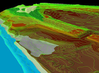
 LIDAR can measure distance, speed, rotation, chemical composition and concentration. This image was produced by a laser beam fired at the ground from a plane to measure the distance to the ground and record the exact position of up to 85,000 points on the ground each second. This data is then used to make a 3-D map of the area.
In the specific case of forestry management, officials will have the ability to identify young forest canopies too dense or at risk for not maturing into fully-developed trees. Furthermore, they will also be able to calculate the heights of individual trees within one or two feet and, in some cases, identify the types of trees observed.
http://www.treehugger.com/files/2007/06/3-d_forest_mapping.php

No comments:
Post a Comment