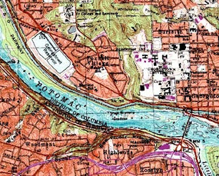
A DRG (digital raster graphic) is a scanned version of a U.S. Geological Survey (USGS) topographic map that also includes the collar information on the published map. DRGs are georeferenced to the Universal Transverse Mercator Projection and use the same datum as the published map, either NAD 27 or NAD 83. DRGs are available from many sources (some free and some for a fee) including state geospatial data clearinghouses, the USGS, and private companies that have business agreements with the USGS. USGS DRGs are available in scales: 1:250,000, 1:100,000, and 1:24,000.
http://egsc.usgs.gov/isb/pubs/factsheets/fs08801.html

No comments:
Post a Comment